The Heggen Pages Toolbar


Top:Regional:Salem:

Mill Creek Gage Readings


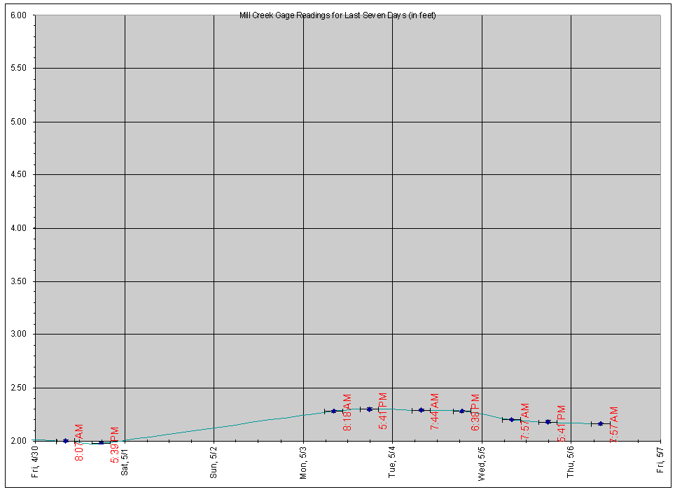
Here are the gage readings on Mill Creek at the Duck Inn (20th and Ferry Streets) for the last seven days. This creek runs through our neighborhood, as well as many others in Salem. It caused us a great deal of grief in the Flood of '96, so we like to keep an eye on it, especially when we get heavy rain. As a matter of information, Mill Creek starts in Stayton at the Santiam River, where a set of headgates control flow into the creek. So, Mill Creek is influenced both by rainfall and by snowmelt, as the Santiam originates in the Cascades.

If you live near the gage and would like to give me regular readings, please send me some e-mail. For reference:

  • 4.0 feet is bankfull (creek is as full as it "should" really get).
  • 4.2 feet on the gage is about to the top of the concrete retaining wall on the Duck Inn side of the creek, which means it's already at the bottom of the 21st Street bridge and close to going into 21st Street next to the Circle K store.
  • 4.3 feet is flood stage (creek is starting to come over its banks in places, causing very minor flooding).
  • 6.0 feet on the gage is about even with the top of the headgates for the Mill Race at Millrace Park (this is bad).
  • In the February 1996 flood, there was no gage. The estimated crest was at 7 feet, which is the highest in living memory.
  • In the November 1996 flooding, the estimated crest was at 5.5 feet.

7days.gif (35033 bytes)
Last Seven Days


Page created 1/17/99 by Michael Heggen.
Last updated 03/17/03 at 14:36.
© 1999 by Michael Heggen. All rights reserved.

Thwate Web of Trust Notary sealReturn to top-level of the Heggen Pages
Home - What's New - Welcome - Feedback - Subscribe

 © 1995-2004 by Michael Heggen. All rights reserved, except as noted.